
DISCOVER THE BEST RIDES NEAR US
Whether you're an avid road rider, mountain biker, or just want to get out and enjoy nature we have some great trails near us!
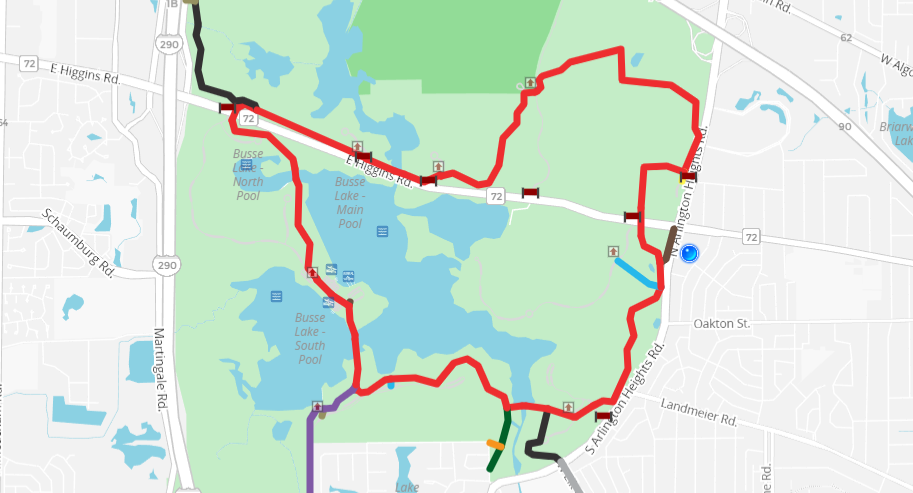
BUSSE WOODS
Home to our namesake 7 Mile bike trail accross the street from our shop, Busse woods features a continuous 7 Mile paved trail loop with no major road crossings or dangerous intersections. Busse is a popular fishing spot with multiple docks and a boat ramp. It's also a favorite of fat bikers and XC skiers in the winter.
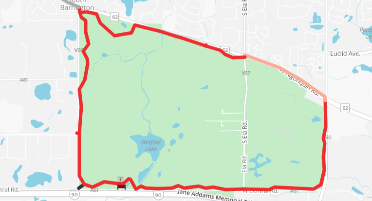
POPLAR CREEK
Located in Schaumburg and Hoffman Estates, Poplar Creek features a 9 mile multi use paved loop with some elevation change and tight turns. It doesn't get as crowded as Busse which makes it good for weekend rides. The west side of the preserve has dirt trails that are popular with equestrians so you might even see a horse!
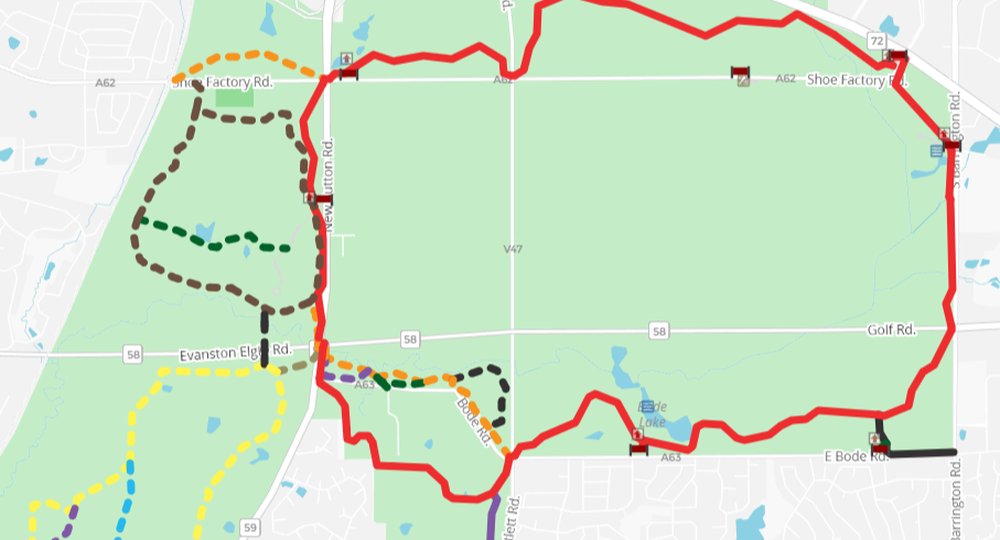
PAUL DOUGLAS
Just across I-90 from Poplar Creek, Paul Douglas Forest Preserve features a quiet paved trail loop about 7 Miles long. The preserve features unique wetlands and big praries that give it unique scenery for the area. A new pedestrian bridge over I-90 at Roselle Rd. make Paul Douglas easily accessible by bike from the Schaumburg neighborhoods
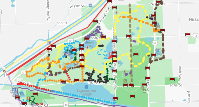
PALOS HILLS FOREST PRESERVE
Palos is the premier place for mountain biking in the Chicago area. The preserve includes about 25 miles of singletrack in addition to gravel doubletrack and a few paved sections. The trails are maintained by CAMBR south with the help of volunteers. Keep in mind the trails are closed when wet.
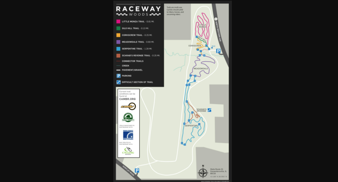
RACEWAY WOODS
Raceway Woods in Carpentersville is the closest mountain biking destination to our shop in Elk Grove Village. The land once was home to the Meadowdale International Speedway which was decommissioned in the 60s. It features about 12 miles of singetrack along with a paved loop. The trails at raceway are maintained by CAMBR north with the help of volunteers to make one of the best mountain biking communities around. Remember that the trails are closed when wet to prevent damage.
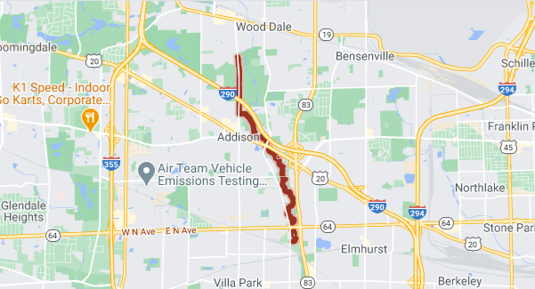
SALT CREEK GREENWAY TRAIL
If you're looking for gravel near our shop, the Salt Creek Greenway trail is a great choice! This multi-surface trail starts right here in Elk Grove and runs South along Salt Creek to the Brookfield Zoo. Along the way you can hop on the Illinois Prarie Path or the Great Western Trail for more gravel adventures.
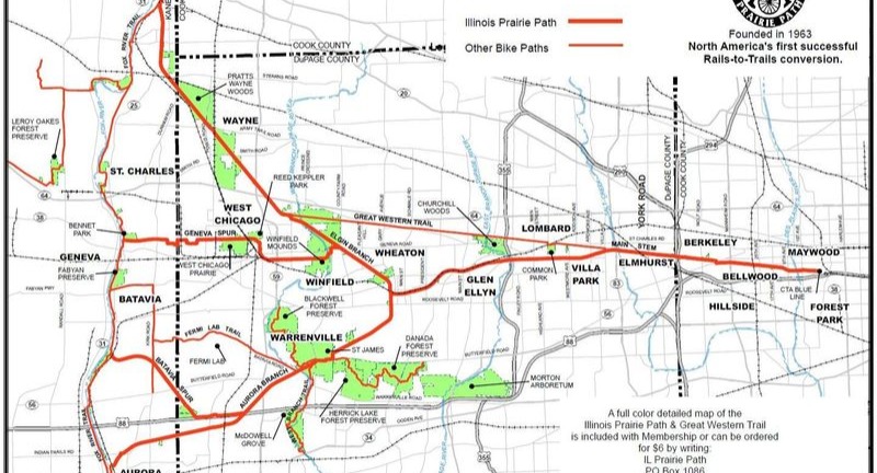
ILLINOIS PRARIE PATH
The Illinois Prarie Path is North America's first successful rails-to-trails conversion. The trail is made of crushed limestone along an old railroad corridor. It runs East to Oak Park where it connects to the Des Plaines River Trail, and West to connect with the Fox River Trail in Elgin, St. Charles, Batavia, or Aurora.
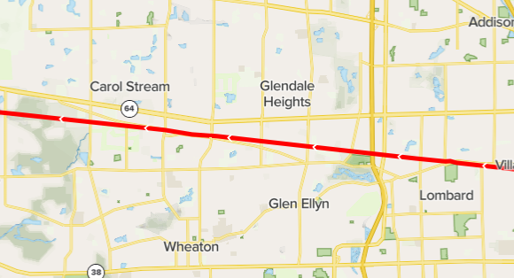
GREAT WESTERN TRAIL
The Great Western Trail is another crushed limestone trail going from Villa Park to West Chicago. One of our shop favorite rides is to take the Salt Creek Trail to where it connects with the Illinois Prarie Path, ride that to where it connects with the Great Western Trail, and loop back around to the Salt Creek Trail. The route is about 50 miles of gravel and paved trails with a variety of scenery.
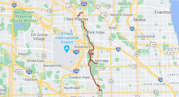
DES PLAINES RIVER TRAIL
The Des Plaines River Trail is a long stretch of gravel and dirt running along the Des Plaines River through Cook and Lake counties. It starts in River Forest at the South end and runs all the way up to Russell at the Wisconsin state line. Along the way you'll pass through downtown Des Plaines, wide open praries, cleared woodland, and swampy marshes. In total the trail is 53 miles long end to end.
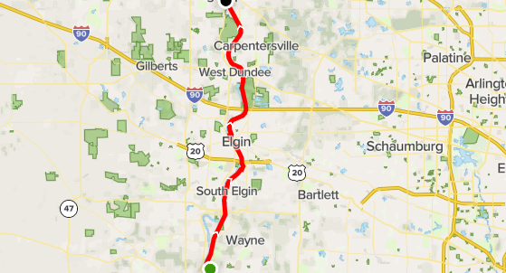
FOX RIVER TRAIL
The Fox River Trail is another mixed surface rail-trail that connects to the Prarie Path and Great Western Trail. The trail starts in Oswego in the South then runs through St. Charles, Aurora, Elgin, and Dundee until it ends in Algonquin. At the North end the Fox River Trail connects to the Illinois Prarie Trail which runs to the Wisconsin state line